


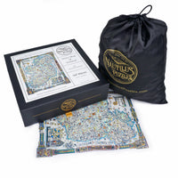

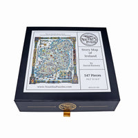
Story Map of Ireland (547 Piece Wooden Jigsaw Puzzle)
- Regular Price
- Sale Price
- $139.95
- Regular Price
- $139.95
- Unit Price
- per
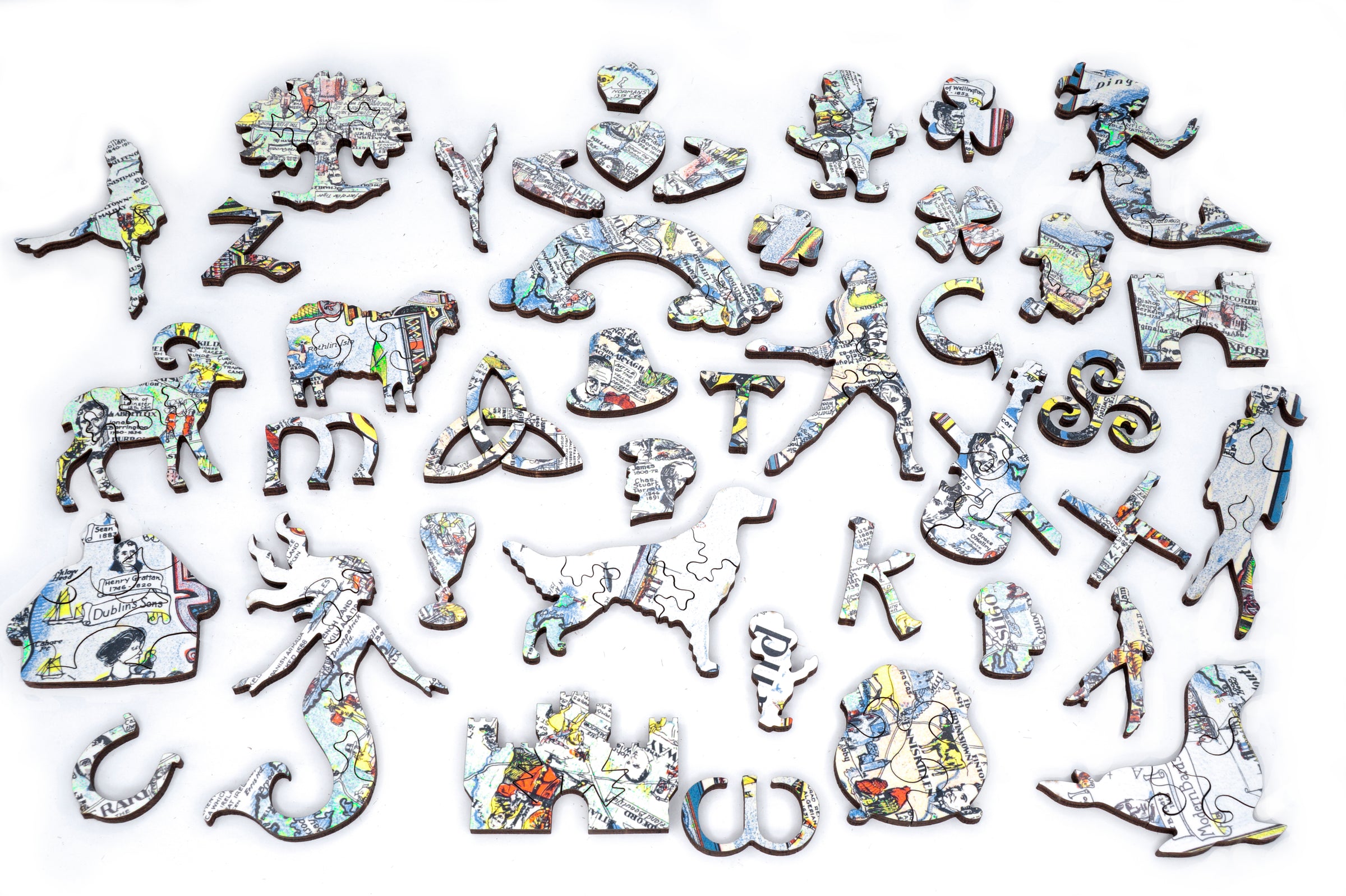
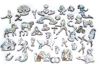
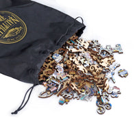
- Every puzzle invites you to discover uniquely handcrafted whimsy (shaped) pieces, thoughtfully designed to complement the image theme.
- Irregular pieces provide an engaging challenge, keeping puzzlers intrigued with interesting shapes and rewarding problem-solving.
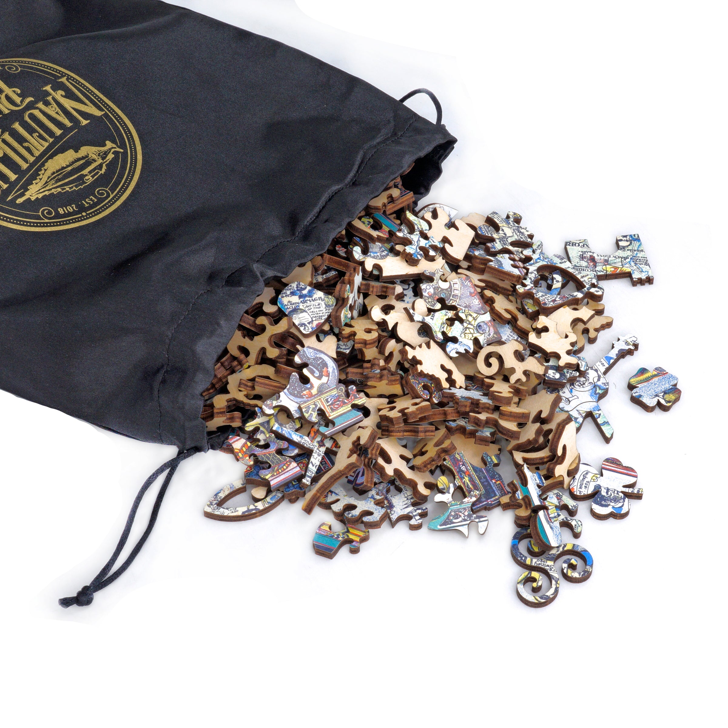
- To ensure exceptional durability, each puzzle is crafted from premium 4mm FSC-certified Finnish birch plywood.
- Nautilus Puzzles are thoughtfully designed and meticulously crafted in the USA, on California's sunny central coast.
- The puzzles are precision laser cut with advanced technology, ensuring every piece fits together perfectly for a smooth and enjoyable experience.
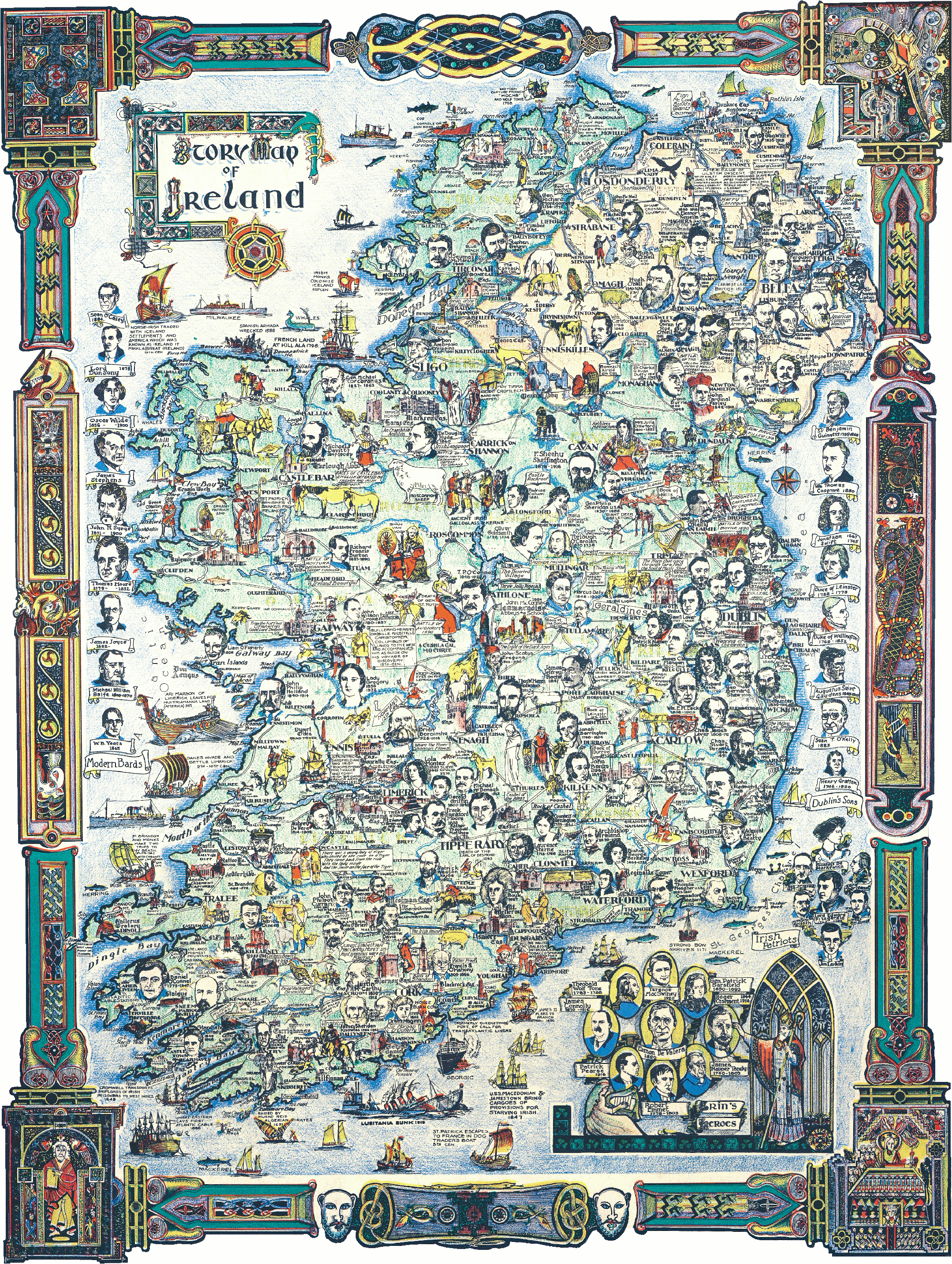
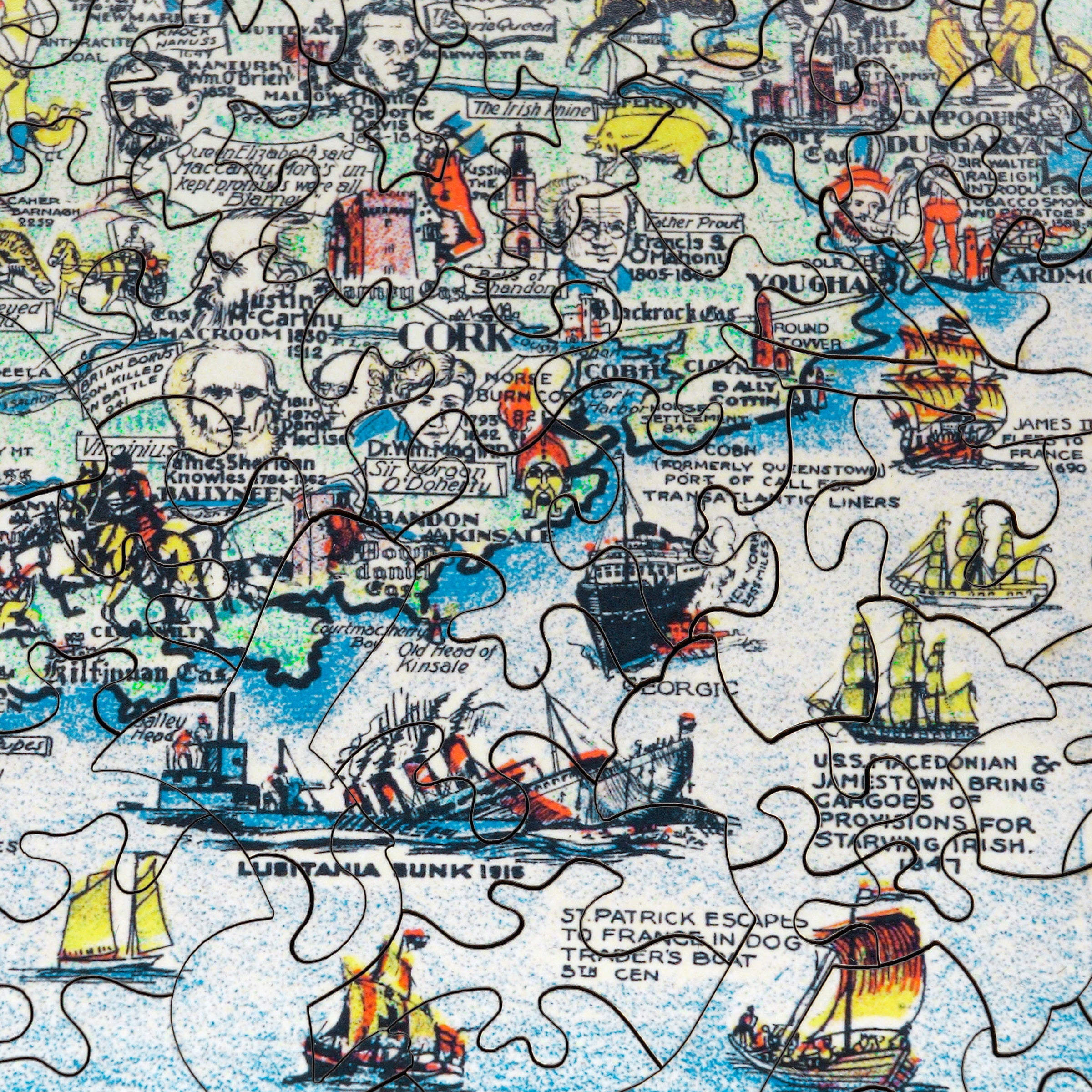
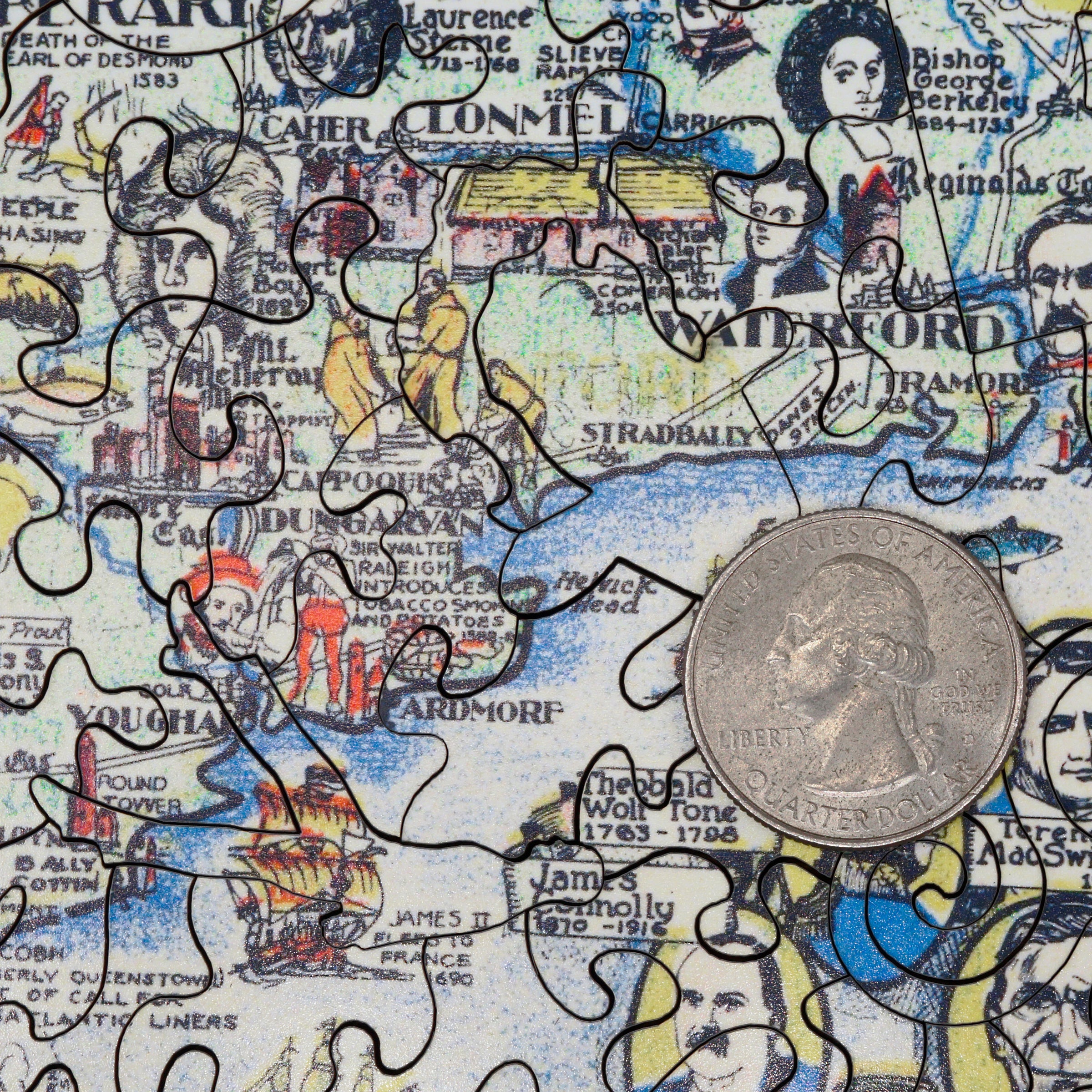
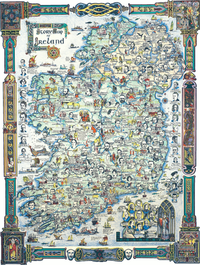
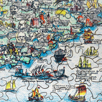
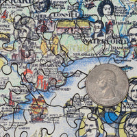
Created in 1935, this delightfully detailed, colorful pictorial map of Ireland was part of a series of "story maps" produced by Colortext Publications of Chicago in the 1930s and 1940s. It features historical facts about Ireland's significant battles, discoveries, and cultural events. It also provides basic geographic details, including elevations, lakes and rivers, bays, counties, and towns.
The intricate borders and title decorations are drawn from the Book of Kells and the Book of Mac Durnan, both remarkable Irish illuminated medieval manuscripts. There are ships in the oceans — historic vessels and others left uncaptioned — and whimsical touches on the mainland, such as a leprechaun. Captions label landmarks such as lighthouses, castles, and universities.
The surrounding seas also contain small groups of portraits: "Dublin's Sons," "Irish Patriots," and "Modern Bards." In the lower right corner, another such group, "Erin's Heroes," is blessed by a Roman Catholic bishop standing before a Gothic window.
Colortext published many educational books and pictorial maps. The "Story Maps" series also included maps of Europe, Mexico, the United States, and the West Indies, all intended to engage and educate America's youth. They also published illustrated booklets about history for children in connection with the Chicago World's Fair Exhibition in 1933 and 1934.
Our puzzle testers have told us that because of all of the text on this map, it presents a nice challenge, so we have rated it a 3+. Enjoy!
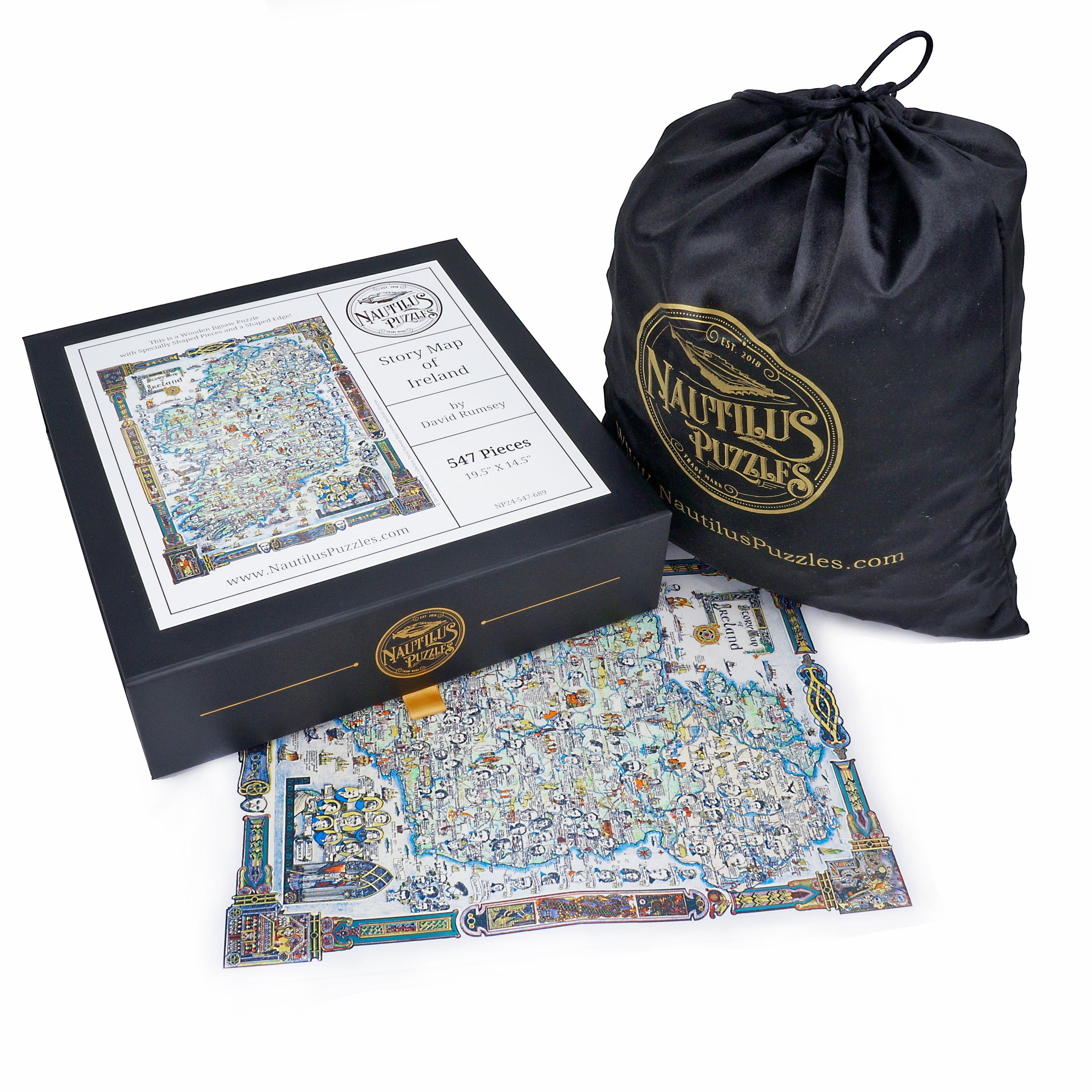
The perfect gift for wooden jigsaw puzzlers, travelers, and map enthusiasts, this traditional adult wooden jigsaw puzzle can be done time and again. Our wooden jigsaw puzzle artists have included many shaped whimsy wooden jigsaw puzzle pieces that match the corresponding areas in the map, and we have integrated them in ways that will delight and surprise you as you put the wooden jigsaw puzzle together. This wooden jigsaw puzzle is perfect for friends and family and comes with a wooden jigsaw puzzle poster for assembly.
- Includes a bonus poster to guide assembly
- Irregular Edge for a Little More Challenge
- Number of Wooden Jigsaw Puzzle Pieces: 547
- Completed Wooden Jigsaw Puzzle Size: 19.5” X 14.5”
- Artist: © David Rumsey Map Collection
- Serial #: NP24-547-689
- Wood Thickness: 4mm
- Design Cut Style: Modern
- Difficulty: Level 3+
- Made in the USA
- Wooden Jigsaw Puzzle
- Serial #: NP24-547-689
- Includes a Bonus Poster to Guide Assembly
- Made in the USA
- Number of Puzzle Pieces: 547
- Completed Puzzle Size: 19.5” X 14.5”
- Design Cut Style: Modern
- Difficulty: Level 3
If you order before 2:00 p.m. Pacific, your order will be shipped that day. Orders after 2:00 p.m. are shipped the next business day (M—F).
Delivery charges are calculated at checkout based on the weight/volume of your shipment and the shipping address.
USA Free Shipping: Offered on orders over $75 in value. Typically takes 8 - 10 Business Days, and the last mile is delivered by USPS. Please choose a paid shipping method if you cannot receive USPS delivery or if you are shipping to Alaska, Hawaii, U.S. protectorates, APOs, FPOs, or P.O. Boxes.
USPS Ground Advantage: 6 - 8 Business Days
UPS Groundsaver/Surepost: 7 - 9 Business Days
USPS Priority Mail: 2 - 4 Business Days
USPS Priority Mail Express: 1 - 3 Business Days
UPS 2nd Day Air: 2 Business Days. No Saturday Delivery
UPS Next Day Air: 1 Business Day. No Saturday Delivery
For your peace of mind, all orders are sent using a tracked courier service. Once your order has been picked up, you will receive an email with the tracking details, allowing you to monitor your shipment's progress.
Orders outside the U.S. are not eligible for Free Shipping. Please choose your paid shipping method during checkout. We offer DHL, UPS, and USPS Priority Mail for international shipments.
Customs and Import Duties: If your puzzles are being delivered outside the USA, your order may be subject to import fees. These are stipulated by each individual country and are not collected or remitted by Nautilus Puzzles. Unfortunately, as we cannot advise you on the amount of these fees, we recommend contacting your country’s customs office or tax agent for the respective rates.
Returns - Peace of Mind Guaranteed: If you are less than delighted with your new puzzle, you can return it to us within 30 days of receiving your order for a full refund or store credit. We ask that it be unused and in its original condition and packaging (shrink-wrap not removed).
If you contact us in advance, we can email you a prepaid shipping label that you can print and affix to your return. To request this label, simply provide your order number and reason for return to our customer service team at help@nautiluspuzzles.com. Shipping costs will be deducted from your refund/credit, but they are charged at our volume discount shipping rates rather than the standard retail rate.
Please note we can only accept custom puzzles for return or refund if there are quality issues, as these items have been produced specifically for you.
